
Lakewood Neighbors Source by Source
A block lookup works only when each source answers its own question. Pierce County PublicGIS defines the nearby parcels. ATIP supplies the owner and tax-mailing facts omitted from downloadable GIS data. Lakewood's Neighborhood Connections program identifies civic groups and meeting channels, but it does not publish member names. Voter data is restricted by purpose and is not a general neighborhood directory.
| Source | What It Shows About a Block | Access |
|---|---|---|
| Pierce County PublicGIS | Parcel outlines, adjacent lots, measurements, and selected map layers | Free map; names come from ATIP |
| Assessor-Treasurer ATIP | Owner or taxpayer, situs, mailing address, parcel, and legal description | Free parcel search |
| Lakewood Neighborhood Connections | Association areas, meeting places, and public contact routes | City program page; no member roster |
| Voter data request | Eligible public registration fields within a requested geography | Political-use certification and state limits |
| PALS/CED+ and PublicGIS layers | Permits, projects, zoning, utilities, transport, and public-safety context | Current and archived city searches |
An owner's mailing address can differ from the Lakewood situs address. That may reflect an entity, a care-of address, or an owner elsewhere. No parcel card identifies every occupant. Keep three columns in your notes: parcel, legal owner, and any separately verified public contact. Do not collapse them into one claim about your neighbors.
Click Outward Across Lakewood Parcels
The Pierce County PublicGIS map supports locate, zoom, search, identify, measure, and layer controls. Find the starting address, select its parcel polygon, then click outward one lot at a time. Include lots across the street if the aim is the immediate block. A radius can pull in land separated by a fence, road, water, or nonresidential tract, so visual adjacency is often clearer than a broad buffer.
County metadata says parcel data is maintained daily and published each evening. The downloadable map data does not supply individual names; the Assessor-Treasurer is the source for owners. Use the parcel number shown by the map to open the matching ATIP record.
The map interface shown below comes from the Lakewood Neighborhood Connections source captured for this project.
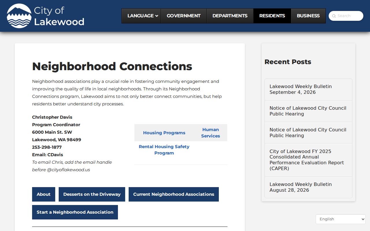
Its public areas and meeting details add civic context after parcel research, but the program does not reveal who occupies a home.
Map a Lakewood Block Carefully
Create an adjacent-parcel log before looking for names. This prevents a corner lot, condominium unit, public tract, or road-separated parcel from being treated as the wrong neighbor. Keep both situs and mailing addresses because they answer different questions.
- Locate the exact Lakewood address in PublicGIS and confirm the selected polygon.
- Log the parcel numbers that touch it and the parcels directly across the road.
- Open each parcel in ATIP and record the situs, owner, mailing address, and legal description.
- Mark any owner-occupancy clue as dated evidence, not proof of current occupancy.
- Use the full Lakewood street directory when the question expands beyond the immediate block.
The parcel ID is the safest join key. Street text varies with directionals, unit numbers, postal labels, and city boundaries. Inside Lakewood, the city assigns the address while Pierce County keeps the parcel and tax record.
Lakewood Neighborhood Connections
The city's Neighborhood Connections program lists activity for Fort Steilacoom, Tillicum/Woodbrook, Downtown, Oakbrook, Lake City, Custer, Springbrook, and North Lakewood. It shares public meeting places, event notices, and routes to community contacts. These groups help identify which civic area surrounds a block.
| Community area | Useful public route |
|---|---|
| Fort Steilacoom, Oakbrook, North Lakewood | Neighborhood Connections association and event listings |
| Tillicum/Woodbrook, Lake City, Springbrook | Area meetings and city engagement contacts |
| Downtown and Custer | Public association activity and program updates |
A March 2025 city bulletin described a leadership group and draft map for future or smaller associations. The current 2026 page also lists local outreach events. Neither source creates a public member directory, so contact the named group through the published city channel instead of seeking a private roster.
Lakewood Neighbors and Voter Data
Washington voter files are not an unrestricted block directory. Under RCW 29A.08.720, public fields may include name, address, year of birth, and voting history, subject to protected voters and other withheld data. Voting history records participation, not ballot choices.
A county or state extract requires the requester to certify political use. Commercial advertising or solicitation is prohibited, and RCW 29A.08.740 carries criminal and civil consequences. For personal block curiosity, use parcels and open civic contacts. Do not seek a voter extract as a shortcut to a list of your Lakewood neighbors.
Myth check. Public voter data does not reveal ballot choices, and a registered-voter address is not proof of current occupancy.
Lakewood Block Layers Beyond Names
PublicGIS groups layers for parcels, environmental conditions, places of interest, political boundaries, public safety, transportation, and utilities. These can explain how a road, shoreline, school boundary, or utility corridor shapes the practical block. They provide context, not personal details.
Lakewood PALS/CED+ adds current project and permit evidence by property. Older permits remain in an archived search after the city's system migration. A permit can identify an applicant, contact, project, status, or inspection date, but it does not name all people at an address. When the online summary is thin, request the specific city project file.
Near Lakewood's edge, check jurisdiction before choosing the permit or code custodian. ZIP 98439 can overlap Lakewood, Tacoma, and part of JBLM context, while 98496 has a special PO-box history. Postal wording alone does not define the block.
Official Lakewood Records Versus Tools
Commercial neighbor tools may merge old addresses, phone listings, and third-party files without showing why two facts were joined. An official source is narrower but gives a named custodian, defined field, and correction path. Neither category proves everyone in a household.
| Question | Official record route | Commercial category |
|---|---|---|
| Which lots are adjacent? | PublicGIS parcel geometry | Map may use unclear or stale boundaries |
| Who legally owns a parcel? | ATIP owner or taxpayer field | Source and update date may be unclear |
| Which civic group serves the area? | City Neighborhood Connections | Community labels may be informal |
| How is an error fixed? | Contact the named public custodian | Correction route varies by provider |
Use the smallest official source that answers the question. If a name or address conflicts, keep both results dated and ask the custodian to confirm the current record.
Protected Lakewood Neighbor Addresses
Washington's Address Confidentiality Program gives eligible participants a substitute address accepted by agencies. Protected voter and marriage procedures can keep an actual residence out of new public records. Certification lasts four years, although records created before enrollment are not erased automatically.
A missing or substitute address is a boundary, not a puzzle to defeat. Utility customer data, delivery records, school details, driver information, and many household facts also stay outside an open neighbor search. Never infer that a silent source proves no one lives at the parcel.
Privacy Limits for Lakewood Neighbors
Use block records for civic curiosity, understanding parcel lines, meeting a community association, scam checks, or personal safety. Keep your notes to the facts needed. Avoid publishing a private person's address or assembling a public contact list from parcel, voter, and directory fragments.
Washington law prohibits stalking under RCW 9A.46.110, and threats or harassment should be reported through the proper channel. In an emergency, call 911. For a non-emergency Lakewood Police matter, use (253) 287-4455. Records that appear public can still be inaccurate, old, or tied to a person with the same name.
A sound block search keeps source and date beside every fact. Record the ATIP parcel number, the PublicGIS layer date, and the association page used. If a deed or permit supplies a different name, do not merge it with the parcel owner without checking the document date and role. A grantor may have sold long ago, and a permit applicant may never have occupied the property. When ownership matters, ask the Assessor-Treasurer or Auditor to confirm the live record. When neighborhood boundaries matter, use the city association description alongside the county map. This careful method makes the Lakewood neighbors search useful for community contact and local history while limiting false claims about people on the block.
Shared drives, condominiums, and large parcels can make the nearest mapped owner look closer than the nearest front door. Read parcel lines first, then use lawful, ordinary contact through the relevant community group.
Lawful use. Never use Lakewood neighbor records to watch, follow, harass, threaten, or intimidate anyone. Respect protected and private addresses.