
Lakewood ZIP Code Coverage
Four postal contexts matter in a Lakewood search. The main delivery labels are 98498 and 98499. The 98439 area needs a jurisdiction check because official planning material connects it with Lakewood, Tacoma, and part of Joint Base Lewis-McChord. The fourth, 98496, is a Lakewood post-office-box code rather than a normal citywide delivery area. None of these boundaries should be treated as the city polygon.
| ZIP Code | Areas Covered | Post Office | Notes |
|---|---|---|---|
| 98498 | Lakewood residential and community delivery area | Lakewood classified branch under Tacoma postal administration | Common city label; ZIP and city edges may differ |
| 98499 | Lakewood residential, Downtown, and city-address use | Lakewood classified branch under Tacoma postal administration | Also appears in broader Lakewood and Tacoma descriptions |
| 98439 | Lakewood, Tacoma, and a portion of JBLM context | Lakewood classified branch | Not every address is a Lakewood city parcel |
| 98496 | Lakewood post-office boxes | Lakewood classified branch | Created October 15, 2006; not a normal delivery ZIP |
The Pierce County Open Data ZIP map supplies polygon geometry and filter or export tools. USPS remains the authority for whether one address is deliverable under a given ZIP. The assessor confirms the tax parcel, while Lakewood confirms an address it issued inside the city. Those are four separate answers.
Open the county ZIP polygon source before viewing its captured map interface.
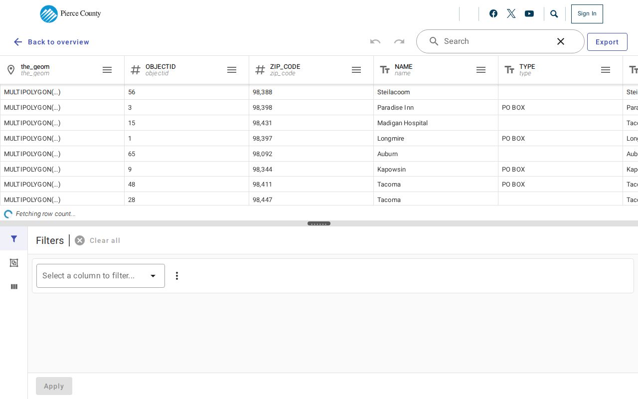
The county map helps spot boundary overlaps, but it does not provide a household roster.
Lakewood ZIP 98496 Explained
USPS Postal Bulletin 22189 records an exact local change. ZIP 98496 took effect on October 15, 2006 for part of the Lakewood classified branch's post-office-box service. Those boxes had previously used portions of 98439, 98498, and 98499. This is a postal-service shift, not a change to Lakewood's city boundary.
That detail matters when matching records across time. A person or group may keep the same box while the printed ZIP changes. Search both the former and new ZIP in dated material, and keep the record's publication date. Do not map 98496 as though it represented a neighborhood of homes. Its value in a ZIP code directory is historical continuity.
Lakewood ZIP 98439 Boundaries
Official planning and USPS material place 98439 in a Lakewood, Tacoma, and JBLM context. The postal label alone cannot show whether the site is a city parcel, a military address, or another jurisdiction. Camp Murray adds a separate state-owned setting, and the cited planning material says it has no residential uses onsite.
Check the physical site before attaching a city label to a person or property. USPS verifies delivery. PublicGIS shows county geometry. ATIP supplies the parcel and jurisdiction fields where present. A military mailing address may not have the same ownership and parcel pattern as a private Lakewood lot.
Boundary check. Save the postal city, ZIP, parcel jurisdiction, and city-address result as four distinct fields.
Find Lakewood Residents by ZIP
A ZIP-wide search is a chain of address and parcel checks. ATIP does not expose a stable anonymous command to return every parcel in one ZIP. It searches property address, owner, parcel, plat, and sales information, and may display ZIP in the result. PublicGIS can support spatial browsing when its ZIP or parcel layer is enabled. VoteWA is an individual voter-service tool, not an open resident list.
- Validate the full delivery address with USPS, including unit or box detail.
- Open the county ZIP polygon and PublicGIS parcel layers to locate the area and jurisdiction edge.
- Search each candidate address or parcel in ATIP, keeping situs and mailing fields separate.
- Use permit, voter, or historical directory sources only for their distinct lawful purpose and access route.
Once the ZIP has narrowed the map to a named street, the Lakewood street directory provides the parcel-by-parcel workflow. It is more exact than trying to turn a large postal zone into one list.
Lakewood ZIP Portal Keys
Lakewood's official systems use different keys. That mismatch is useful when handled with care. An address from USPS can lead to a parcel in ATIP. The parcel then bridges to PublicGIS and the legal description. PALS uses the site address or project for city permit work. A voter data request is arranged by precinct or district rather than an ordinary public ZIP search.
| Source | Accepted key | ZIP role | Main limit |
|---|---|---|---|
| USPS lookup | Full delivery address | Validates postal ZIP | Does not establish city jurisdiction |
| Open Pierce ZIP map | Map filter or polygon | Shows ZIP geometry | Not an address authority |
| ATIP | Parcel, address, owner, plat | May show ZIP as an address field | No stable all-parcels-by-ZIP mode found |
| PublicGIS | Map search and parcel selection | Spatial ZIP and parcel check | Names route back to Assessor |
| PALS/CED+ | Address, parcel, project | City permit address evidence | Older permits use archive |
The Pierce County property page says parcel number is the best lookup key. Preserve it even when a street or ZIP changes. The parcel connects modern property facts to maps and deeds more reliably than a postal label.
Read Lakewood ZIP Address Fields
Three fields often look interchangeable but are not. The situs address is where a parcel sits. The mailing address receives tax notices and may belong to an owner, care-of contact, trust, or entity somewhere else. The legal description identifies the land by subdivision, lot and block, or metes and bounds. Deeds rely on that legal identity even when a street label changes.
A ZIP is postal geography layered on top. A Lakewood mailing label may reach beyond city limits, and a parcel near Lakewood may carry Tacoma or military wording. Keep all three property fields plus the ZIP. Do not infer that the taxpayer occupies the situs address, or that everyone receiving mail at one box lives within the mapped ZIP.
Older Lakewood ZIP Directory Labels
Lakewood incorporated in 1996, but its communities and postal history are much older. Earlier records may use Tacoma, Tacoma Suburban, Lakewood Center, Lake City, Lakeview, Tillicum, Oakbrook, or another local label. The Lakes District grew from 3,000 people in 1939 to 17,000 in 1949, long before a Lakewood city file existed.
The Northwest Room's Tacoma Suburban directories are organized by name and address from 1928 through 2021. Its Buildings Index can connect an address with families, companies, builders, dates, and source citations. Search an old ZIP alongside the older community name and street spelling. A missing city-name match may reflect the catalog's geography, not a missing resident.
Note: No official source identified a Lakewood-wide street renumbering year, so compare plats and legal descriptions instead of guessing one.
Lakewood ZIP Records Are Partial
Property, permit, voter, and directory sources cover different populations. ATIP lists owners and taxpayers, not all occupants. PALS may name an applicant or project contact, not a household. A voter file omits people who are not registered at that address and protected voters. Historical directories may omit unlisted homes or place them under a different community label.
Washington voter data has strict use rules. Public fields may include name, residence address, year of birth, precinct, and voting history, but not ballot choices. County data requests ask for district, precinct, voting-history, matchback, or other data and require a political-use certification. It is not a casual ZIP code directory download.
No official ZIP-specific table of all Lakewood residents or registered voters was found. That gap should remain visible. Search the smallest lawful record set that answers the question, and verify an individual result with its custodian.
Lakewood ZIP Codes and City Limits
Pierce County assigns addresses only in unincorporated areas. Lakewood is the address authority for city parcels, while Pierce County still keeps parcel, tax, and deed records. This split explains why a city-issued address and a county-held property record can both be correct. It also explains why the ZIP code directory cannot settle legal jurisdiction on its own.
Use the city permit center for an address assignment or correction inside Lakewood. Use ATIP for the county parcel. Use the Auditor for deeds, after converting the parcel and owner facts into the party names and recording dates that Aumentum accepts. Recheck the boundary at the 98439 military edge and whenever a PO box is involved.
- ZIP and ZIP+4
- A five-digit delivery area and its four-digit add-on, which narrows mail to a smaller route, block, building, or box group.
- PO-box ZIP
- A code assigned to post-office-box service, such as Lakewood's 98496, rather than a residential map area.
- Unique ZIP
- A code assigned to one high-volume organization. No unique institutional Lakewood ZIP was verified in the research.
- Carrier route
- The group of delivery points served by one postal route. It is not the same as a city or parcel boundary.